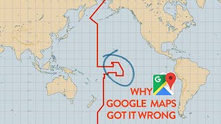
The International Date Line, Explained
It reveals that Google Maps incorrectly maps certain Cook Islands on the wrong side of the line compared to authoritative sources like PacIOOS, highlighting how these 'fake borders' reflect political choices rather than summaryGoogle Maps contains an error regarding the Cook Islands: it places them on the 'Tuesday side' (ahead of GMT), whereas official data from PacIOOS and GMT-10 status confirm they are on the 'Monday side' (behind GMT).takeaway“In short, all of these islands are on Monday side. PacIOOS has it right, and Google Maps has it wrong.”quote